Showing posts with label iceberg. Show all posts

Thursday, 9 August 2012

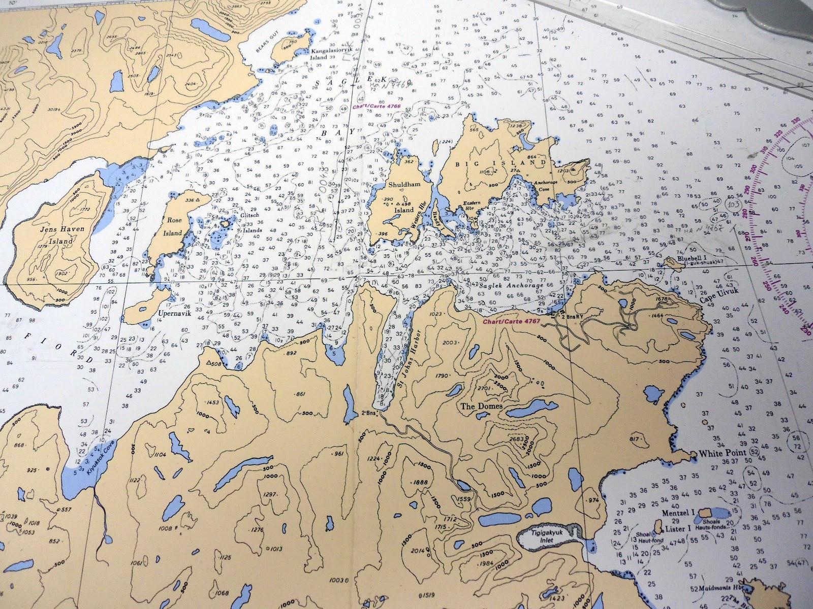
Shuldham Island

20 July 2012 continued.
There's an archaeological site on the southeastern corner of Shuldham island where Callum Thomson (Jane's husband and Jimmy's father) did his graduate work in the 1980s. The Smithsonian Institute team found about two dozen tiny soapstone sculptures of humans, polar bears, birds, fish and even a whelk shell, about a thousand years old, among the earliest soapstone sculptures ever found in the Canadian Arctic (now in Newfoundland museum). We did not land however, the Parks Canada guards had spotted three polar bears on Shuldham Island, so we cruised around the island instead in Zodiac dinghies, from 4:30 to 6:30 pm.

Shuldham island is in the mouth of Saglek Fiord.
Four Zodiacs from the ship and two Parks Canada boats,
probably discussing bears. 
The Parks Canada crews.
A common murre - must be injured as it didn't dive or fly away.
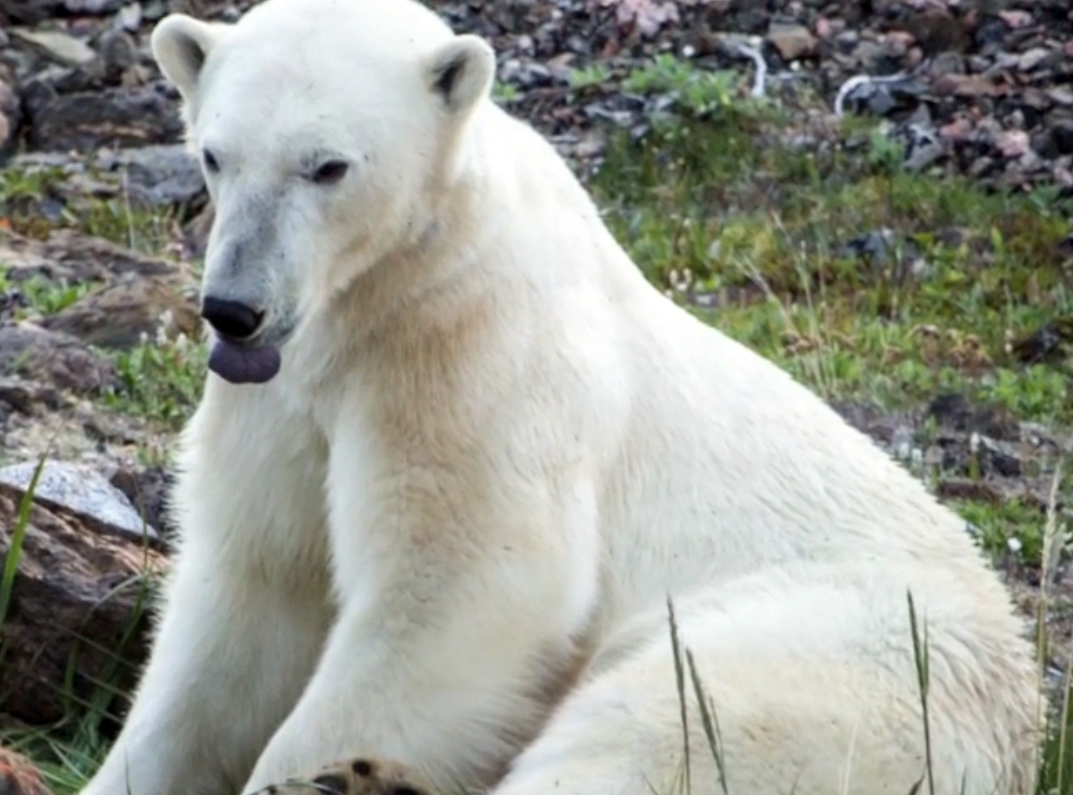
A very relaxed polar bear. Mostly he lay down and
covered his eyes with his paws, not very photogenic
but possibly to keep bugs away.
I took this with my Samsung point and shoot camera.
Still from slideshow
Continuing around the island. A bad place to be shipwrecked.
Strange clouds, lenticular?
This bear looked very stressed. Other zodiacs had seen it on
 the far side of the island and it had run away, dived in the sea
and then saw us and changed his mind about swimming
to the next island. We thought it best to leave.
Still from slideshow.
Polar bear decides to return to shore. Still from slideshow.
We didn't see the third bear.
A bergy bit (too small to be an iceberg).
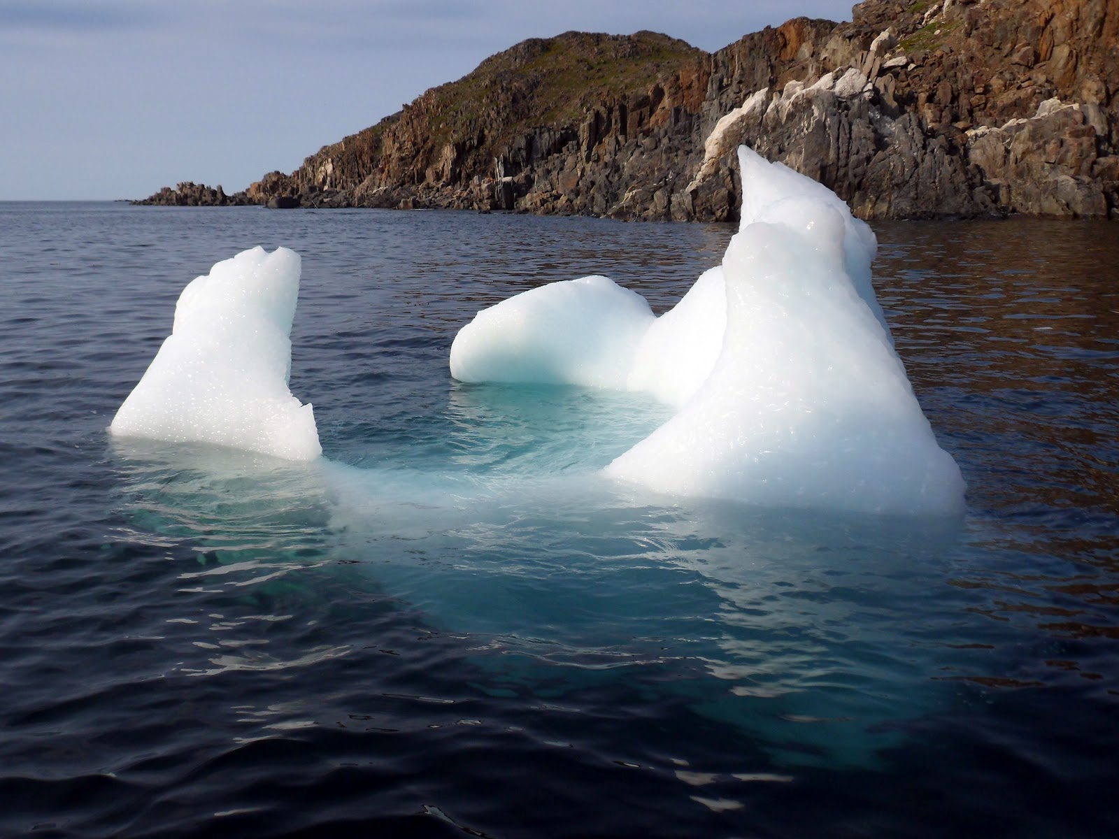
Iceberg to the north of Shuldham Island.
We went round it in the Zodiacs.
Different view of the same iceberg.
This is an iceberg seen from the ship at about 9 pm, about sunset.

Sunday, 5 August 2012

Okak and Mugford Tickle

18 July 2012
The tide was wrong for a landing at Okak island so we
landed instead on the mainland just to the north 
When looking for an anchorage
both captain and first mate are on duty on the bridge
The captain keeps an eye on the depth
A wet landing, gumboots required. Water temperature
6 degrees C. Air temperature 4 degrees C at 7 am.
Bear scat, caribou antler
Stone tent circle (tent ring).
Ramah chert, sought after for making tools.
More caribou antlers
The first shore party checked out the bear situation before
we landed. Each group had an armed guard in case of polar
bears. A third guard was up high.
A vole or lemming skull
Our ship in the distance
Me again. This area had a great variety of flora:
crowberries, blueberries, willow,  Labrador tea,
butterwort,  and wintergreen. See the next post...
Mugford Tickle is a narrow but deep channel between two
islands with 1000 foot high cliffs on each side of half mile wide
channel. There was a strong, cold wind, choppy sea, and low
cloud or mist, so we did this on the ship.
Mountains and mist
A grounded iceberg in Mugford Tickle.


Saturday, 4 August 2012

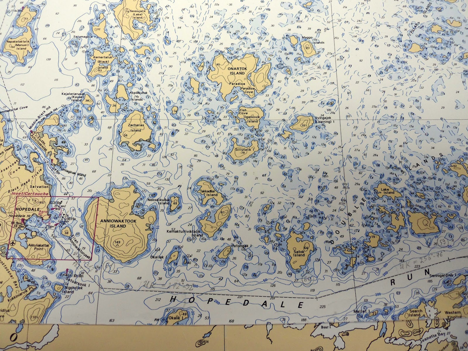
Hopedale

17 July 2012.
11° C, light cloud, small icebergs
Hopedale is on the mainland, on the left. Click to enlarge.
Hopedale residents
Friendly dog and woodpile
We hiked to the top of hill for a view of Hopedale
and our ship in the bay, from former DEW line base
Boris is one of our armed polar bear guards as well as the
boss of the Zodiac drivers. Sean Cadigan is on his left.
The Moravian mission in Hopedale, next to the church
(see also entry on Moravians in "Labrador and Nunatsiavut"
for  photos of church)
Moravian church and mission buildings with field of cotton grass
The museum was very interesting here. Tools, 18th century musical instruments, medical equipment, and so on. It was a choppy wet ride back to the ship on the Zodiac. The ship had to be moved (with bow thrusters) to create a lee for transfers from the Zodiac, as the end of the gangway was under the waves.
Sunset and icebergs
The first mate, Alexander, steered nearer the iceberg on request!

Tuesday, 31 July 2012

Strait of Belle Isle; Battle Harbour, Labrador

15 July continued:

Whales and icebergs

The Strait of Belle Isle is considered a wildlife superhighway, linking the relatively warm waters of the Gulf of St. Lawrence with cold Atlantic waters (the Labrador current) coming from the Arctic Ocean. Fish and marine mammals  travel north and south along this narrow corridor in search of food and have attracted people to the area for thousands of years.

Iceberg in the Strait of Belle Isle. Icebergs break off glaciers
in Greenland and travel south with the Labrador current at
an average speed of 0.7 km/h (but up to 3.6 km/h)
Sooty shearwater. Shearwaters have narrow wings, have to run
over the water to get up speed for take-off. 
Whale and distant iceberg.
Most whale sightings were of the "tha she blows" variety.
Minke whale - the only one I learned to identify. 
It doesn't blow much.
Battle Harbour
Located on a rocky island, Battle Harbour is Newfoundland and Labrador’s only intact salt fishing village, maintained by a local historical trust. The mercantile salt-fish premises at Battle Harbour were originally established by John Slade & Co of Poole, England in the early 1770s. Salt fish is cod that has been cleaned, split, salted and dried. 
After 1820, the population increased when Battle Harbour was declared capital of the floater fishery. "Floater fishery" consisted of Newfoundland fishermen who fished in Labrador waters in the summer, and returned to Newfoundland in the fall. 
In 1892, Dr Wilfred Grenfell arrived. In 1893 he built Labrador’s first hospital here. 
The 1904 Marconi wireless telegraph station is marked by a plaque on the high point of the island.
Robert Peary held his press conference here in 1909, claiming the first successful expedition to the North Pole. 
In the late 1960s residents were encouraged to move to the mainland, mostly to Mary’s Harbour. In 1990 the Battle Harbour Historic Trust was founded: it maintains buildings and operates boats, inn, site tours, and lunches.

These are "flakes" where the split cod was dried. When it looked
like rain the women rushed out to stack and cover up the cod.
Hudson Bay Company net store. HBC rented nets to fishermen.
The evening ferry from Mary's Harbour has just arrived
(plus some of our group in the red wetskins are about
to embark on Zodiac dinghy).
Although it was sunny in Battle Harbour, it was cold - the first cool day on this trip.

This is Kyle's more dramatic view of Battle Harbour.
A highlight of the tour of the village was entering the Anglican Church to find Jim Payne playing the organ. Jim is the One Ocean "artist-in-residence" on the ship, singer, multi-instrumentalist, hiker, gardener and Zodiac driver. His website is http://www.singsonginc.ca/  For the past few years he has spent the week between Christmas and New Year's touring oil installations on the Grand Banks of Newfoundland.